I took off Friday to spend the day with Christine, probably one of our last "free" days together. We ended up messing around the house for a bit and later in the day went for a short hike at Gunpowder Falls State Park, just north of Baltimore. The Gunpowder River is one of those famous trout streams you read about in Field and Stream and what not. The trails there are really beautiful and follow along the river. Down in the valley you wouldn't think that your are only 10 miles north of Baltimore. The river valley is filled with laurels and rhododendrons so you think really your up in the mountains somewhere. The only draw back is that there can be a lot of people there and it seems nobody thinks they need to keep their dog on a leash. Our dog hates dogs, and if you've ever had to pass an unleashed dog with a dog who wants to kill other dogs while hiking through a laurel tunnel then you'd know why I wish everybody would keep their dog on leash. It isn't pleasant. Fortunately, it was Friday afternoon and everybody else was at work and we had a nice relaxing hike. That is until the end when Christine tripped over a root and banged up her knee. She was pretty upset, more that she has this 30 lb thing inside her that's messing with her equilibrium than the fact that it hurt.
Saturday was another chill day. We needed to clean the house because Natalie and Michael were coming on Sunday, but we decided to put it off until the sun went down. So we threw the dog in the truck and headed to Patapsco Valley State Park. We went to the northwest end of the park and set out on a nice long hike. Here is the Map:

As you can see from the satellite map, Patapsco is unmistakably an urban park. If the houses bordering the park don't give it way, the fact that it is less than 5 miles from BWI and directly under the flight path will! Still it's a pretty nice chunk of green space. Most of the trails are built and maintained by M.O.R.E., the Maryland mountain bike advocacy group. There are roughly 30-40 miles of trails in the park.
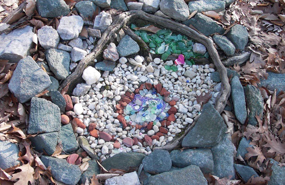
In one area, some trail pixies have created little shrines in the woods made from broken glass and bricks. I'm not sure why but they are kind of pretty.

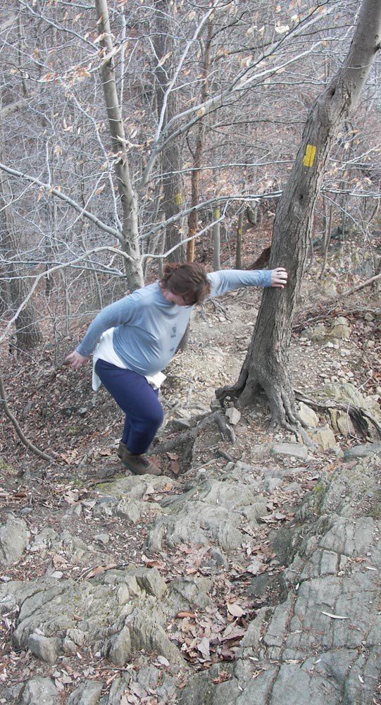
Last but not least, here's Christine hiking up the Buzzard's Roost trail. It's actually quite steep. Check out the trail blazes on the trees behind Christine. That's straight down... I'm not sure how much longer she's going to be able (or should) to do this. I offered an alternate route to the top, but she said that's the way she wanted to go!


As you can see from the satellite map, Patapsco is unmistakably an urban park. If the houses bordering the park don't give it way, the fact that it is less than 5 miles from BWI and directly under the flight path will! Still it's a pretty nice chunk of green space. Most of the trails are built and maintained by M.O.R.E., the Maryland mountain bike advocacy group. There are roughly 30-40 miles of trails in the park.
In one area, some trail pixies have created little shrines in the woods made from broken glass and bricks. I'm not sure why but they are kind of pretty.

Last but not least, here's Christine hiking up the Buzzard's Roost trail. It's actually quite steep. Check out the trail blazes on the trees behind Christine. That's straight down... I'm not sure how much longer she's going to be able (or should) to do this. I offered an alternate route to the top, but she said that's the way she wanted to go!


No comments:
Post a Comment